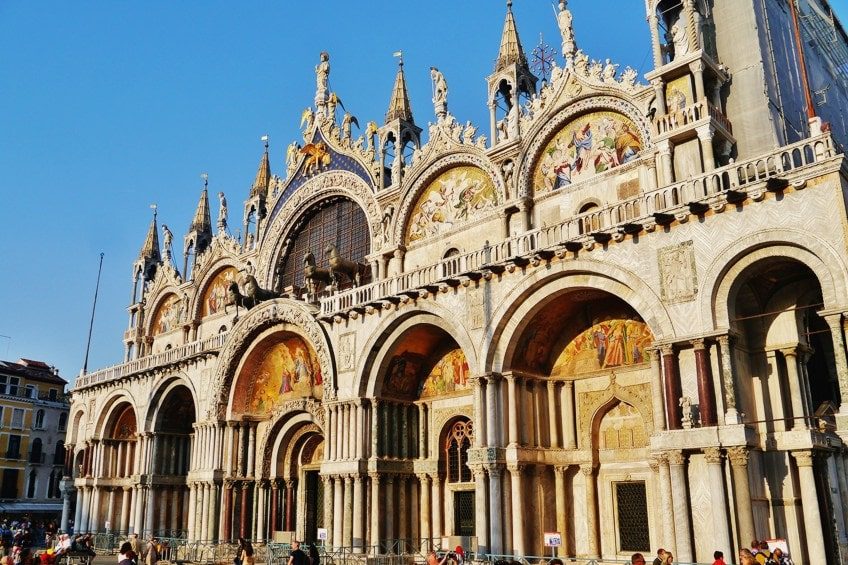
St. Mark's Square
The primary public space in Venice, flanked by the Basilica and the Doge's Palace. It serves as the central hub for most walking routes.
Arrive before 10:00 to view the mosaics without large crowds.

Venice is a city built for walking, with over 400 bridges connecting 118 islands across six historic districts. Every route through the floating city becomes a self-guided discovery of Gothic palaces, hidden courtyards, and centuries-old canals. A clear pedestrian map turns potential confusion into confident exploration.
Quick answer
A Venice walking tour map organizes the city's six sestieri—Cannaregio, Castello, Dorsoduro, San Marco, San Polo, and Santa Croce—into navigable pedestrian routes that connect major landmarks like Piazza San Marco, the Rialto Bridge, and the Accademia. Public walkways are free to explore year-round, though individual attractions charge separate entrance fees. Early morning walks between 08:00 and 10:00 offer the calmest streets and the best light for photography before cruise ship crowds arrive.
Venice contains no roads, only 178 canals and more than 3,000 calli—narrow pedestrian lanes that form the city's circulation system. A reliable venice walking tour map identifies not just the famous squares but the sequential bridges and turns that prevent walkers from dead-ending at canal edges or circling the same campo three times. The city's medieval layout resists grids, and smartphone GPS often lags when tall buildings block satellite signals. The most coherent self-guided routes in Venice follow the sestiere boundaries, each district offering distinct architectural character and crowd density. Cannaregio stretches north from the train station toward the Ghetto, its wide fondamenta providing unobstructed canal views. Castello extends east past the Arsenale shipyards, where residential neighborhoods replace souvenir stalls. Dorsoduro anchors the southern edge with the Accademia gallery and the Zattere promenade along the Giudecca Canal. San Marco concentrates tourist infrastructure around the basilica and Doge's Palace, while San Polo and Santa Croce preserve markets and artisan workshops west of the Grand Canal. Pedestrian wayfinding in Venice relies on yellow signs mounted at intersections, pointing toward five permanent landmarks: Piazzale Roma, Ferrovia (train station), Rialto, San Marco, and Accademia. A comprehensive walking map layers these directional markers onto topographic reality, showing which bridges have steps (impassable for wheeled luggage) and which fondamenta offer flat, continuous pathways. The longest uninterrupted walk—from Piazzale Roma to the Giardini Pubblici—spans approximately 4.5 kilometers and takes 70 minutes at a steady pace without stops. Official city maps are available at Venezia Unica service points near transport hubs, and free public routes remain accessible around the clock throughout the year. Seasonal variations affect comfort more than access: summer humidity slows midday movement, while autumn and winter fog softens palace facades into impressionist compositions. Printing a route map before arrival ensures navigation continues when phone batteries drain or data connections falter in stone-walled alleyways.
“Venice contains no roads, only 178 canals and more than 3,000 calli that form the city's pedestrian circulation system.”
Admission costs for exploring Venice on foot depend entirely on whether you are navigating public thoroughfares or entering specific cultural sites. Accessing the city's public walking routes incurs no charge.
Verdict: A typical adult pays 0 EUR to walk the city, with total costs increasing only if choosing to enter specific paid attractions.
Venice is located in the Metropolitan City of Venice, Italy. Most walking tours begin near the city center, accessible primarily by water transport or on foot from major arrival hubs.
Trenitalia to Venezia Santa Lucia station
ACTV Vaporetto Line 1 or 2 to San Marco/San Zaccaria
Water Taxi to private hotel pier or public landing
From Piazzale Roma or Santa Lucia station
Plan your arrival for 08:00–10:00 to avoid peak cruise ship crowds and midday heat. Use the official site https://www.veneziaunica.it to check transport schedules before departing.
A full-day route connecting Venice's six historic districts, suitable for first-time visitors with a printed or digital map. Allow 6–8 hours including breaks, covering roughly 8 km on foot.
Start at Piazza San Marco to see the basilica exterior and palace facade before cruise groups arrive. Photograph from the waterfront, then move west.
Cross the Grand Canal at Rialto and walk through the morning produce stalls in San Polo. The market quiets after noon.
Head north into Cannaregio's residential alleys and the Jewish Ghetto; fewer tourists, authentic workshops. Stop for lunch at a bacaro.
Walk south over the Accademia Bridge into Dorsoduro. Pass the Peggy Guggenheim Collection exterior and continue to the Zattere waterfront.
Circle back through Santa Croce, the least-visited sestiere, to see everyday Venetian life. Note: many small campi have no signage—keep your map handy.
End at Via Garibaldi or the Giardini Pubblici in Castello for a quieter sunset view. Retrace your steps or take vaporetto line 1 back to San Marco.
A Venice walking tour map fails most often for two reasons: phone navigation loses its bearings between six-storey walls, and walkers start too late in the day. Both are avoidable with a little preparation.
Trusting GPS alone in narrow calli
Signal bounces or drops entirely in the tight lanes of Castello and San Polo, so your blue dot drifts by 50 metres or more. Download an offline map and navigate primarily by the painted yellow wall signs pointing to San Marco, Rialto, Ferrovia and Accademia.
Setting out late and hitting cruise-ship crowds
Aim for the 08:00–10:00 arrival window to avoid peak cruise ship crowds and midday heat. Walking routes themselves are accessible 00:00–23:59, but the alleys around Rialto become shoulder-to-shoulder by 11:00.
Assuming the map scale matches walking time
Distances look short on paper, yet bridges, steps and dead ends stretch a 1 km line into 25 minutes or more. Add roughly 40 percent to any straight-line estimate.
Not marking a bridge-free or step-light route
Dozens of stepped bridges cross the route; wheels and strollers stall on them. Mark accessible crossings on your map before leaving, or plan vaporetto hops between sestieri.
Assuming every stop on the map is free
Public walking routes cost 0 EUR, but individual churches, towers and museums along them set their own charges and hours. Check each attraction separately on https://www.veneziaunica.it before you build your day around it.
Carrying no paper backup
One drained battery erases your entire route. Print the map or screenshot each leg, and note two fixed landmarks per section so you can re-orient without a phone.
Navigating Venice on foot reveals a network of historic landmarks that define the city's unique urban layout. Use these key locations as reference points to orient yourself while exploring the pedestrian-only streets.
The primary public space in Venice, flanked by the Basilica and the Doge's Palace. It serves as the central hub for most walking routes.
Arrive before 10:00 to view the mosaics without large crowds.
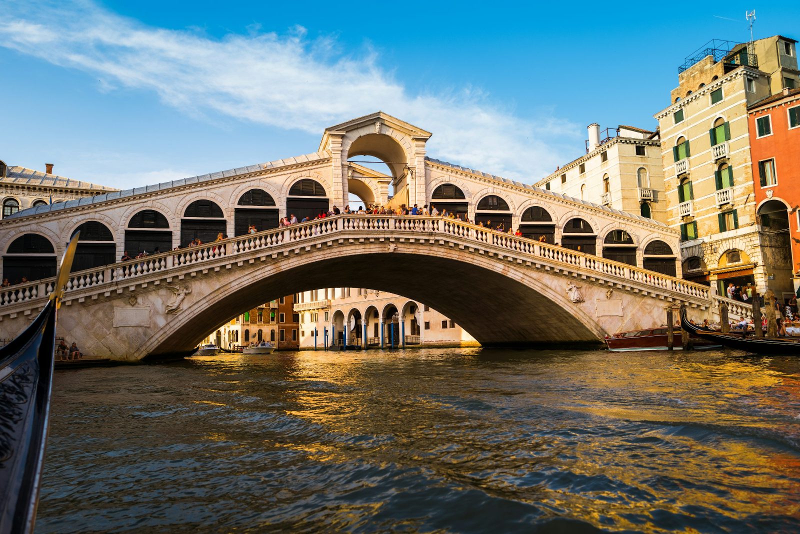
A stone arch bridge spanning the Grand Canal, offering expansive views of the waterway. It marks the divide between the San Polo and San Marco districts.
Stand at the center point for the best canal perspective.
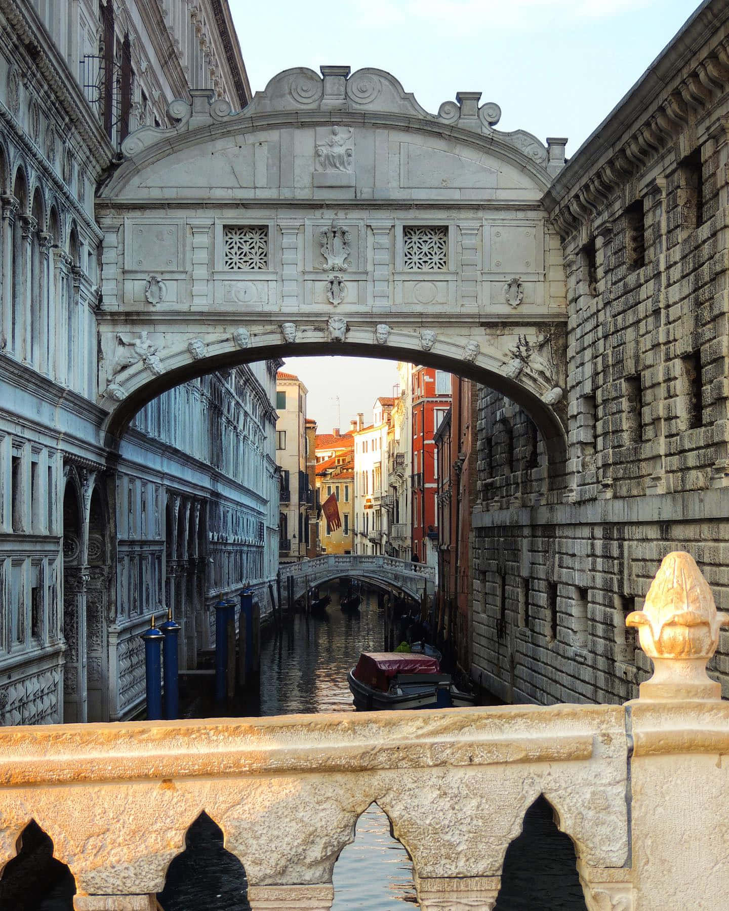
An enclosed limestone bridge connecting the New Prison to the Doge's Palace. It is best viewed from the Ponte della Paglia.
Look toward the palace exterior from the neighboring bridge.
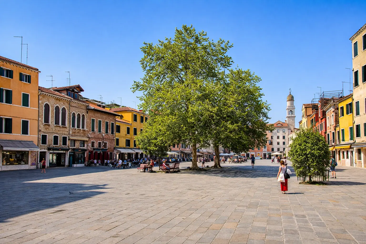
A large, open square in the Dorsoduro district known for its local atmosphere and historic buildings. It provides a quieter alternative to central tourist zones.
Walk the perimeter in the morning to observe daily life.
Everything you need to know about venice walking tour map
While the city is labyrinthine, a well-structured venice walking tour map helps travelers navigate the winding alleys and bridges efficiently. It ensures you do not miss hidden architectural gems while exploring the historic center.
Many visitors prefer downloading a digital itinerary to supplement their paper venice walking tour map. Official tourism portals or reputable travel guides are the most reliable sources for accurate routes through the city landmarks.
The standard map primarily highlights public pedestrian paths and historic plazas. Access to specific sites like the Doge's Palace or Basilica di San Marco often requires separate entry arrangements, which are handled independently of the route itself.
Public walking routes are entirely free, and you can explore the city at your own pace without costs. Specific attractions along the path may charge individual entrance fees, but the streets themselves remain open to all.
For the most enjoyable experience, we recommend starting your journey between 08:00 and 10:00. This early arrival window allows you to avoid the heaviest concentration of cruise ship crowds and the midday heat.
Walking paths offer the best way to appreciate the famous Venetian canals and bridges. By following a structured route, you can easily transition between major sites while enjoying the unique atmosphere of the city.